'The Overlander': travelling from Darwin to Adelaide by horse in 1889-90
Published in a 9 part series in the Northern Territory Times and Gazette of 1890, this is the diary of 'The Overlander'. He tells the story of his journey across the continent in about 16,000 words. He travelled by train and horseback. He even joined the 'ruby rush' in Alice Springs. A keen observer of the countryside, his tale is well worth reading.
Overlander 17 Jan 1890 NTTG ACROSS THE CONTINENT
Port Darwin to Adelaide.
[By Overlander].
Although many persons connected with the Overland Telegraph Line, and others, have travelled from station to station, none have as yet attempted to give your readers any idea of the natural features of the country, or any particulars as to the waters, climate, or mode of travelling on the track of what will become at no distant date, the great Trans-continental Railway Line. I will, therefore, endeavour briefly and concisely to give your readers some notion of the overland route.
Starting from Port Darwin on the north by the 8 a.m. train, the traveller passes through a tract of most uninteresting country, the land on each side of the line being poor and stony, and the timber invariably stunted by centuries of bush fires, the only redeeming feature in the landscape being the frequent creeks and waterholes on the line of route.
Here and there a good patch of land will be seen upon the margin of a running water- course, but the general appearance of the country is not such as to tempt a farming community. The first stopping place of any importance on the journey is the Adelaide River, 75 miles from Port Darwin, and even in the driest time of the year, this is a pleasant running stream. Over this river a fine iron bridge has been erected, at a sufficient height to avoid the enormous floods which occur during the rainy season. Passengers for the mining districts are allowed twenty minutes stay at this station to enable them to obtain refreshments, after which they are whirled through the country at about 20 miles an hour until the Pine Creek Station is reached. This station is about 146 miles from Palmerston, and is the present terminus of the line, but it is hoped that another year will find the extension of the line to the Katherine authorized, if not actually in course of construction. I have purposely avoided any allusion to the mining districts on the line of route, such as the Howley, Union, Mount Wells, Yam Creek, and Pine Creek, as your readers are kept fairly posted in the news of your mines every week, by writers who are better able to express an opinion than I am. From Pine Creek to the Katherine, a distance of 70 miles, I accomplished on horseback, although there is a weekly mail service by buggy, for those who prefer that mode of travelling.
The country is somewhat more undulating than the road from the Port to Pine Creek, and several stony ranges of hills have to be crossed. Similar to the road from Palmerston to Pine Creek, the grasses and under- growth along the track still retain their tropical character, being tall and coarse, and are not of much value for stock until the rank grass has been burnt off by passing bushmen, who take every opportunity to thus make room for a splendid second crop of young and tender feed, upon which both horses and cattle thrive well. The country after passing Pine Creek, bound South, improves in character, and the timber which is chiefly gum, is thicker and heavier, especially on the banks of the Cullen, Fergus-son, and Edith Creeks.
The Fergusson, which is distant 22 miles from Pine Creek, is a dangerous creek to cross in the rainy season, and several foolhardy travellers have paid the penalty for their rashness in trying to cross it when flooded, with their lives. The banks being boggy and steep, it is always wiser to camp for a few days until the river goes down, in preference to risking the loss of their cattle, and probably their own lives. The Cullen and Edith are the next important creeks to be negotiated, and both of them are dangerous during flood. While upon this matter, pardon my saying that lives have been lost at nearly all these creeks, for which the callous negligence of the Government has been chiefly to blame, in not having either provided punts or wire cables for the assistance of travellers, and, worse still, neglecting to erect tidal poles, by which strangers could tell the depth of the water. 27 miles beyond the Edith the Katherine River is reached, and after crossing the innumerable miserable little creeks and water-courses on the road, it is a treat to see a fine stream, some 150 yards wide when in flood (as I saw it). At this river a useful boat is kept by the Telegraph Department, and I need hardly say that it is a perfect boon to travellers. During the height of the wet season the Katherine is really a magnificent river, and it would be a bold swimmer who would make the attempt to cross it when in flood. When I first saw the stream I considered it the grandest sight I had seen on my trip through the Continent, but I was told that in the year 1879 the water rose considerably higher, in fact up to within a few feet of the Telegraph buildings. About six years ago a new Telegraph Station building was erected, to replace the old building which had been made to serve as house and office since the construction of the line, and a portion of the old building is now utilised as a kitchen, storeroom, &c. The station ia prettily situated on the Southern side of the river, and is as comfortable a place for a weary traveller to drop into, as could well be found in Australia.
I must not pass by the Katherine without a grateful word of thanks to Mr. Murray, the stationmaster, and Mrs. Murray, their kindness and hospitality, which are well known to all overlander, and are unostentatiously and cheerfully extended to all who visit the district. It is not easy to drag one's self away from such comfortable quarters, but I must push on to the next camp or your readers will begin to tire of my verbosity.
After leaving the Katherine River I had a good chance to observe that the surrounding country was somewhat thickly timbered, with some of the finest gum-trees to be seen between Beltana and Port Darwin, and the banks of a few creeks which I crossed were lined with really magnificent trees. Leaving the Katherine the country is somewhat less stony and rough, but a few small ranges have to be crossed, and are visible from the track, the general appearance of the country does not alter much, but here and there a few tall cypress pine trees are to be seen in the scrub, but gum trees still predominate over other descriptions of timber. I wish I had taken more interest in natural history in my younger days as I could have then described the strange bushes and plants I frequently dropped across, far more fully. Water is abundant at moderately easy stages, but no creek of any size is met with until the King is reached, about 30 miles from the Katherine. The next station of interest is the Elsey, which was established as a repairing station, but has been closed for some years past. The building was a decidedly modest structure of two rooms. About two miles from the telegraph line is the head homestead of the Elsey cattle station, consisting of a comfortable manager's house and several out-buildings. The Elsey Creek, from which the cattle station takes its name, is distant about 104 miles from the Katherine, and was at the time of my visit flooded.
Fortunately there was an iron boat at the crossing, so we were enabled to cross in safety, although the horses had to swim the stream, and had as much as they could do to get clear of the boggy banks on the landing side. After leaving the Elsey the country gradually rises slightly for a few miles, and then becomes almost dead level, with dense scrub and rank grass and under-growth. The next stopping place at which a halt was called is known as No. 2 Well, on the Burdim, and is the Northern boundary of what is known as the Burdim country. From this camp to the Daly Waters Station, a distance of 80 miles, the country is nothing but a dense scrub, and is low lying, Bay of Biscay country, which is anything but pleasant to ride over in dry weather, and still worse when the ground is swampy after heavy rains. The timber is very stunted, and although gum trees are very plentiful, they are very small compared with those in the neighbourhood of the Katherine River; in fact, they are more like the bastard or mountain gum, only growing to a height of 15 to 20 feet, and are ill-shaped and stunted. On this stage I found plenty of feed and water, but the season when I passed through was a very favourable one.
As you approach close to the Daly Waters Station, mulga country is passed through. The timber, resembling the southern she-oak, grows from 20 to 30ft. high, and is found in large patches of miles in extent, so dense in places, that it would be almost impossible to ride through. The last 14 miles as you approach the station, you ride through just such a patch of mulga scrub as I have endeavoured to describe.
The Daly Waters Station (275 miles south of Pine Creek terminus) is situated on a level piece of ground on the bank of a creek, and is surrounded by fair-sized gum trees. This creek does not contain a permanent supply of water, but a large water-hole contains- sufficient for the requirements of the station, except in a dry season, when water has to be carted several miles, and the live stock is removed a few miles further down the creek until the looked-for rain falls. The Telegraph Station building was rebuilt some five years ago, the old building becoming unfit for occupation; like the new station at the Katherine River, the building is of iron with a veranda all round, and is raised on piles some three feet above the ground. The country for miles round as far as the eye can reach is quite level, and there is no landmark of any kind to guide the traveller who strays from the track of the telegraph line. The soil in the neighbourhood of the station is of a yellow clayey nature, very different to the black sticky soil found further north. The grasses are rank and coarse, but not so much so as those previously noticed. The country cannot be considered really good stock country and although all kinds of stock except sheep seem to do well on it, they have hitherto proved a failure, and I was told that in one season (some 9 years ago I believe) the sheep on the station were so thin and miserable, that one weighing 20 lbs. when dressed was considered fat. Most of those who read this journal are aware that the country from Southport to the Katherine River, has every geological evidence of being rich in minerals, and the same formation exists until the King is reached (about 27 miles south of the Katherine), after which the character of the country changes, and it has no appearance of being mineral bearing until you get to the neighbourhood of Powell's Creek. Even here although the country looks better, there is not much in its appearance to induce prospecting. After leaving Daly Waters Station, which I should mention is about 275 miles south of Pine Creek, the country remains very level and uninteresting for about 30 miles, when mulga scrub is again met with, and continues with only a few breaks of a mile or so, right down to the Peake. The mulga trees make splendid camp fires, and after supper bushmen are
glad to make themselves comfortable near the fire with two or three good logs on, which will last through the whole night. I can assure you it is a real treat after a somewhat lengthy stay in the tropical Northern Territory to get into a climate where the glow of a good fire is acceptable.
The climate as you get further South is more like the Southern Colonies, and in the dry season it is very cold at night and towards daylight, and one can thoroughly enjoy a roll in a couple of thick rugs near a blazing camp fire. The next waters reached on the overland route was Frew's Ponds, and when I saw them they were flooded, and the surplus water had spread over a large extent of country, which then resembled an enormous lake, and was literally swarming with wild fowl. From Frew's Ponds, still proceeding South, the country gradually rises, and here and there ironstone ridges crop up above the natural surface.
Newcastle Waters, a cattle station owned by the late Dr. Browne, is the next point of interest reached. The head station comprises the usual manager's house, kitchen, store, &c. At the time of my visit, the Newcastle was flooded, and we had to cross as best we could at the road crossing, where fortunately, the water was only, a few feet deep, but the stream was about 80 yards in width.
From the Newcastle, the country again changes in its natural features, and becomes much rougher, and a bold range of hills loomed up ahead of us. As we near Powell's Creek, the road and telegraph line ran for some 15 or 20 miles through high ranges. From the highest point on one of these ranges, we obtained a splendid view of Lake Woods, which is situated some 15 miles to the west. The lake appears to be much closer than it really is, and with the rays of the morning sun lighting up the waters, it was a very picturesque view. The lake is a very large one, estimated by some of the residents in the district to be from 15 to 20 miles in circumference, and is bordered to the waters edge with dense timber, which at a distance, looks like large gum trees.
As we got further south, and into the rougher country, we made a somewhat too close acquaintance with what is known in the bush as porcupine grass, or "spinifex" and the whole of the country for miles round the Powell's Creek Station, seems to grow little other vegetation than spinifex. The stock run is about 15 miles from the Telegraph Station, and to the west of the telegraph line. The soil in the neighbourhood of the station is excellent, and all kinds of vegetables grow readily, especially in the rich ground on the banks of the creek.
In very dry seasons the water is not permanent, and the stock have sometimes to be shifted, but there is a shallow well, which provides sufficient water for station use in nearly any season.
To be continued.
24 Jan 1890ACROSS THE CONTINENT
Fort Darwin to Adelaide.
[By Overlander].
(Continued).
Leaving Powell's Creek, for the first six or seven miles the traveller passes over stony spinifex ranges, when the country becomes somewhat more open. The soil being sandy and only timbered with small gum trees here and there but there is a profuse growth of lance wood for several miles along the roadside, and as far as one can see on each side of the track. This timber is very trying to travel through, both for man and beast, it being a thin wiry tough wood, that when dry will scarcely give way before you, and often inflicting unpleasant scratches on both yourself and horses-not to mention tearing one's clothes into shreds, if compelled to ride through it, which not unfrequently occurs if your pack-horses keep running off the track. Fortunately after they have .been through it once or twice, they seem to prefer the track. There is still very little grass along the road, except a few small patches here and there-mostly spinifex country. Twenty miles of this sort of travelling brings us to Renner's Springs Cattle Station, situated on a creek which takes its rise from a' natural spring on the edge of a fine open plain, which stretches away to the eastward from the Springs and Telegraph line. There are high ranges to be seen in the distance on the eastern side of the plain, and the country in the other directions appears to consist of small open flats, with a few small hills here and there. The creek is overgrown with teatree and reeds, but has a good supply of water, which I believe is permanent. Although this creek may not water all the stock on the station in a dry season, there is sufficient to keep the homestead well supplied. The plain above mentioned was (when I saw it) beautifully grassed, it being a first-class season the grass was of splendid quality, and the horses relished it after having to put up with the hard and dry porcupine grass.
Going on from Renner's Springs the country shows a great improvement upon the spinifex country - we have been passing through for the last 30 miles, being, more open, less spinifex and fairly well timbered. The next creeks and watering places are the North, Middle, and South Tomkinson, three fine large creeks. The North and South Tomkinson contained abundance of water (when I saw them.) These creeks are lined along their banks with fine larger trees, mostly gum, and much larger than any we have seen on the road for some time past. The beds of the creeks are all sandy, and splendid grass country is found on the banks and for some distance around these creeks. From Renner's Springs to the North Tomkinson is about 16 miles the North to Middle Tomkinson eight
miles, and Middle to South Tomkinson,' five miles. The country is of a sandy nature along the track between these creeks. Continuing our journey from the South Tomkinson; our next halting place is Keurchner's, distance about 10 miles. This is a small creek, quite different in appearance from the last ones we passed, being very shallow and muddy, and the soil around the banks & very black and sticky. The water supply is very good, and I believe lasts the whole season, unless in exceptionally dry years. The country around about is of à gravelly formation, and very nice agates are to be found, not very plentifully, and they are of no value, excepting as curios. Looking southward we notice large belts of mulga scrub country, and on the banks of all the creeks grow the inevitable gum.
As we proceed further south we travel through the mulga country for a little way, generally over fairly even country, but when we get into the vicinity of the Morphett, a creek eight miles on from Keurschner's, the country becomes very rough and stony for short distance through the ranges, and then opens out as we approach Attack Creek, into sandy country covered with spinifex in every direction Ten miles from the Morphett brings us to Attack Creek, the largest watercourse we have come across since we left the Elsey, a distance of about 350 miles. Here we found a splendid, supply of fresh, clear beautiful water. The bed of the creek is stony, and we noticed long reaches of water from two to three feet in depth, as far as we could see on each side of the crossing. This creek derived its name through an attack made by natives, on the party led by Stuart, the explorer, across the continent to the northern coast in 1862. This is also one of the two places where I came across natives in their wild state. As we rode out from our camp on our way to Tennant's Creek in the morning, we noticed three natives run down to the bank of the creek some two or three hundred yards away, but they did not give us a chance to get more than a passing glimpse of them, and we continued on our way well satisfied, but we would not have slept so well the night before perhaps, if we had known our dark friends were in the vicinity. Our next camping place was the Phillips, a creek situated about 16 miles from. Attack Creek. The country was almost similar to that which we had travelled over during the last 20 miles, until nearing the Phillips, when the country shows a little change, being more heavily timbered, aud the soil being black and sticky. Every flat around the creek for several miles was very treacherous, letting the horses down without a moment's warning. The flats near the banks of the creek were covered with gum and lignum, and the feed in the neighbourhood was good. Appearances would lead one to suppose the water in the creek to be permanent, as there was an abundant supply, the creek being almost full.
To be continued.
31 Jan 1890
ACROSS THE CONTINENT
Port Darwin to Adelaide.
[Br OVERLANDER].
{Continued).
From the Phillips to telegraph station, about 26 miles, the country passed through is very fair for about half the distance, the feed being good, and a great variety of timber is seen, including gum, mulga, &c. Ranges can be seen in every direction standing out boldly in the distance, in some directions they appear to be high. One or two ranges that we passed over I should say were worth while prospecting, as we noticed some very likely looking quartz reefs in several places ; in fact, the country generally gave one the impression of a mineral bearing country. The stone was of a darkish description on the ranges in the distance, and I should think it was ironstone similar to that at Tennant's Creek, where the hills are almost completely covered with ironstone. Nearing Tennant's Creek, the country is not so good again, and the soil is of a very yellow, hard clayey description, and very poorly grassed, spinifex abounding in every direction, even up to the very doors of the station.
The telegraph station is situated on a flat about half a mile from the creek, and is surrounded by a perfect city of white ant hills, the inmates of which have almost demolished the station, eating every piece of woodwork to a shell. When I visited this station the roof was then being kept on by some old wagon axles tied on to the ends of some telegraph line wire, and slung over the ridge pole, but I believe that the building has since been thoroughly repaired by the department. The creek is a good size, not very wide, but as much as 25 feet deep in places. The water is not permanent although the large waterhole at the station, when full, might give a stranger the impression of its permanency. There was a well put down on the flat close to the station, but after sinking some 60 feet without success, it was abandoned, having failed to strike water. There is also a well on the bank of the creek, which keeps the station going when the waterhole fails in a verv dry season. Taking this station all round, it has a very miserable and desolate appearance, being situated on a flat, which extends a couple of miles to the east, about the same distance to the west, and some considerable distance on the north, without a tree to break the monotony of the view, excepting on the creek, half-a-mile south of the station. ln a good season some fine vegetables can be grown at this station, the garden being on the bank of the creek, close to the waterhole. Principal amongst the vegetables which can be grown here easily, are cabbages, pumpkins, sweet potatoes, &c. Until the recent discoveries of gold at Algebuckina (near the Peake) and Alice Springs, Tennant's Creek was about the only spot on the Overland line except the Northern Territory where gold was known to exist. Almost anywhere about the creeks and gullies, and even close up to the station I believe colours have been obtained in almost every instance where a dish of stuff has been tried, but nothing payable has been found. The prospects fully justify a further search about the locality. Some forty miles out from the station, on Bishop's Creek, gold has also been found, so that we may presume that the country in that neighbourhood is also worth prospect-ing. The country is fairly good stock country, and a little distance out from the station in every direction appears to be well grassed, and the horses, sheep, and cattle all seem to do well.On leaving Tennant's Creek, the country continues of an open character. We pass through a few gum flats,
well grassed, and then come into the ranges which are considerably larger than any we have crossed for a long distance. They are not, however, very rough travelling, there being a fairly
good beaten track through them. I got off mv horse here and examined the stone on account of its verv blackappearance, and I should say, judging by the weight, that it is almost pure ironstone. The ranges around in every direction being covered with nothing else excepting the above – mentioned stone. After clearing the ranges, we come into open country again, and 12 miles from Tennant's Creek we pass through what is called " Little Edinburgh." "Little Edinburgh," is a city of immense size, only unfortunately for the country, it is nothing better than a huge mass of white ant hills, extending beyond the reach of one's vision east and west of the road, and for several miles along the line.
After rains this is one of the most boggy places on the track, the reason being that the ants in building up their dwellings have rendered all the surrounding ground hollow and porous. Thirty miles of travelling brings us to Kelly's Well, our first camp from Tennant's Creek. The country round this spot is very well grassed country, but rather too much timber if anything. Going on again we travel through very fair stock country, and cross several small creeks that are rarely or ever required for watering purposes, and if they were there would be no water in them.
The principal creek which we crossed during this day's stage was the Maclaren, about l8 miles from Kellv's Well. This is a very awkward creek to cross in flood, running through low lying country, heavily timbered, and very boggy on each bank. A peculiarity about the majority of the creeks on the overland journey is that they cross the telegraph line at right angles, and nearly all flow west. There are exceptions, but it is very seldom you will notice a creek flowing in the opposite direction. Six miles from the Maclaren bring us to our next camp, viz., "The Bonney," one of the grandest creeks on the whole route. The channel proper must be something like 120 yards wide, and is divided into about six different smaller channels, so that when a small stream of water is running it looks like so many small creeks, and is easily crossed.
But when flooded it presents a majestic appearance, and the traveller who would venture to cross would be a plucky man, taking into consideration the numerous deep places to be got over, the dense growth of tea tree in the bed as well as on the banks. In flood times the extreme tops of these trees can only be seen. There arefine large waterholes at the crossing of this creek, nearly all the year round, two or three of which are 200 or 300 yards long by about 50 wide, but they fail if the season is very dry. However, there is a good well on the bank of the stream, which is the fall back in the case of necessity. The country around here is sandy, and a fair sprinkling of " porcupine " is encountered. Going on from here the coun- try is changeable from level sandy soil to mountainous stony ranges, and mulga
is the leading feature in the way of timber. We get over several miles of this country, which commences just before reaching "The Dickson." Even here it is not what you can call very rough, but a tender footed unshod horse would think it rough enough. " The Dickson " is the first locality where we make the acquaintance of " Stuart's bean tree," one of the most beautiful shade trees that could possibly befound. In appearance it looks something like a blackwood, but on closer inspection, you will notice the leaves and bark are slightly different, the leaves being shorter and wider, and the bark more smooth, and of a lighter colour. These trees grow to 50 or 60 feet in height, and occasionally you will come across one from l8 inches to two feet in diameter. The beans grow in pods slightly larger than French beans, and when ripe the pod splits open, and exposes the beans in- side which are of a bright scarlet, presenting a very pretty picture when the trees are in full bearing. In some places there are forests of these trees, and they generally seem to grow grow in large belts, which is the case on the banks of the Dickson. This creek is one of the exceptions to the rule as regards direction of course, it running in a southerly direction for several miles, the telegraph line and road following it for three or four miles, then we lose sight of it and afterwards meet it again running across the line in a westerly direction.
The next feature worthy of mention is "The Devil's Marbles." These consist of thousands of tremendous rocks of a sandstone formation, and in most cases they are almost as round as marbles, and are piled up in all directions in every conceivable shape. In one or two. places five or six of these huge boulders are piled upon each other resembling buttresses to some ancient castle One rock is hanging at au angle of about 40° right over the road and only seems to be holding by a pivot. Other blocks resemble huge skittles, altogether a marvellous sight. Water can generally be got in the holes in some of these rocks, sufficient for a couple of men and a few horses. The country here is all porcupine, and very rough travelling, over big stony ranges. Going on the country is of an uninteresting description, porcupine grass and scrub, till nearing the Wauchope (13 miles distant), where fine gum trees are met with again. The Wauchope is a very narrow creek, and very deep, and in a heavy rainy season soon overflows and spreads over the flats which extend for a considerable distance on each side, making them fearfully boggy and the crossing dangerous. Eleven miles from this brings us to the , where we camp for the night. The Wycliffe is a peculiar creek, there being no definite course, sometimes it is running within banks like any ordinary stream, and immediately after it stretches out unrestrained by banks into swamps of immense width but not very deep.
The telegraph line crosses this creek through a swamp such as I have tried to describe for a width of about three miles. The road has taken a more westerly direction and crosses two miles below the line, at which crossing there is a good well. The Wycliffe is not permanent. The bog in the locality is terrific after a big rain. For three miles on from here we pass through nothing else but sand and stunted scrub after which abundance of spinifex is seen for a distance of 30 miles, which brings us to the Taylor. There are two roads from the Wycliffe to the Taylor, one follows the telegraph line the other branches off and goes west, on account of teams being able to get water at a place called " the Sawpit." This track is generally used by teams, following the line there is no water and horsemen generally put up with this rather than ride the extra three miles via the Sawpit. The Taylor is a big sandy bedded creek 80 yards wide, and six weeks after it has been flooded a man might perish for the want of a drink if he relied on it. The creek is a fearfully bad holding one. On the bank of the creek is a well of the most horrible water that I've ever tasted My horses although travelled from the Wycliffe 33 miles through hot sandy country would not look at it, and fortunately I had a waterbag which lasted me into a place (the 16-mile) where there was abundance of water, and I spelled there a day. Starting about the Wycliffe, and extending to the south of Alice Springs, the native orange is to be found, and it is a very fair substitute for the cultivated article. In appearance the tree, blossom, and flower are very much like its name sake, the fruit is not altogether unlike, but growing to a very large size and some of the trees bear wonderfully well. I've seen them absolutely bending beneath the weight of fruit, which is very good eating, the taste is a little woody, but it is nevertheless a treat in the bush. From the 16 -Mile the traveller passes over a bit of flat country densely timbered with mulga, a stray gum here and there, and spinifex galore brings us into the ranges. After passing through these ranges we arrive in sight of Barrow Creek trig. This station is situated right under a very high range with a flat extending south, west, and north, and large ranges running east from the station. The creek, which runs past the station in a southerly direction, is a sandy bedded one, heavily timbered with gum. It is not permanent water, only lasting about ten weeks after it has been flooded.
To be continued.
7 Feb 1890ACROSS THE CONTINENT!
Port Darwin to Adelaide.
[By OVERLANDER].
Continued).
The attack on the Barrow's Creek station, in 1874, arms about one of the most sad affairs that has occurred on the Overland Telegraph line. But it has been spoken of so many times, and the history of the outrage is so well known that I consider it quite unnecessary to go into full particulars.
Suffice it to say that the natives surprised the station about dusk, speared the station master (Mr. Stapleton), Mr. Flint, assistant, and Franks, the cook. Stapleton and Franks died immediately. Mr. Flint, who was afterwards station master at Alice Springs, was badly speared through the thigh, but subsequently recovered.
Mr. Flint who was a general favourite all through the bush, where he was well known and also on the line, died at Alice Springs about three years ago. Another of the survivors of the attack suicided on the Ruby fields, and I think the only one left alive is Mr. S. Gason, of Beltana Barrow's Creek is one of the most prettily situated stations on the O. T. Line, being at the mouth of a gorge and right at the foot of a big range.
The country surrounding the station is fairly good stock country, the principal drawback being the want of water, but in almost any season there is always abundance of grass. The well at the Telegraph station is very brackish in fact almost salt, and although nearly impossible for whites to use, the stock seem to relish it, not unfrequently coming into the trough for a drink of this water after a big rain, when plenty of fresh water is lying about. There are two cattle stations away to the east of the Barrow, one (the pioneer) belonging to the Barrow's Creek Pastoral Company, is now situated at a place called Cornelia Downs, about 100 miles east of the Telegraph line. The first place this Company started their head station was at Ann's Reservoir, about 100 miles north of Alice Springs, and about 20 miles west of the Line. On the same day as the long-to-be remembered attack on Robert's party on the Daly River Copper Mine, N.T., the natives attacked Ann's Reservoir Station, when only two men were at home, viz., the cook and one stockman, and the consequence was that the natives burnt the station to the ground with every thing inside of it, and left the two men terribly knocked about. Fortunately neither of them were seriously injured, and they recovered shortly afterwards. Not long after this the Company shifted the head-quarters to "The , a creek about 18 miles south of Barrow's Creek. They built a stone house, kitchen, outbuildings, yards, &c, put down a couple of wells, and struck a splendid supply of water at a very shallow depth. It was occupied as the head station for about four years, but the manager has now removed the head-quarters to the first mentioned place, viz., Cornelia Downs, where I believe another station has been built. The reason for leaving Ann's Reservoir and the Stirling I do not know, but having been over some of the country in the neighbourhood I should say that it was not from want of grass or water. From Barrow's Creek to the Company's southern boundary (about 140 miles) the grass is first-class and very plentiful, but of course the "porcupine" is still pretty thick in patches, but cattle will do well enough on it. Water in a good season stands well in numerous waterholes, and even if it did not there is abundance to be got by shallow sinking.
So the reason for removing the stations so frequently seems a puzzle. There are between seven and eight thousand cattle, and about 200 horses on this station. The other station is some 30 or 40 miles further east of Cornelia Downs, and it is owned by the Willowie Pastoral Company, and managed by Mr. W. Coulthard. It is situated on the Frew River, and has only been opened for the last couple of years, and I think has between 3 and 4,000
cattle on it. The country is very fair, but there is, I was told, a total absence of salt in the grass and herbage, which makes it less valuable as a good beef-growing country. Rock salt is therefore used for the working horses and bullocks, and for the few milking cows, feet. that are kept about the homestead. The waters are good in fact, some of the holes in the Frew are of an immense size and depth. The natives are very numerous and troublesome on both these stations. We must get on with our journey, as it's a long way to Adelaide yet. Leaving Barrow's Creek, there are two tracks as far as the Stirling, the one following
the telegraph line, and the other winding through a, very rough range,
the Foster, west of the line. The track through the range is the only one that a vehicle can travel on, and as rough as it is the line track is still rougher on account of the number of deep, steep-banked creeks to cross, and several nasty rough little patches in the ranges, which render it simply impossible for a wheeled conveyance to to pass over. The line track is 18 miles, and the road via The Foster Range, about 24 miles to the Stirling.
The line track is thickly timbered with gum and mulga, and nearing the Stirling, I saw real forests of the beautiful Stewart's bean tree. The road is not so thickly timbered until after the range is got over, which extends about twelve miles from Barrow's Creek, and is covered with spinifex, and large gibbers, with a straggling gum here and there. A few small creeks are running through the range and covered with low stunted mallee. The last twelve miles in to the Stirling, after getting through the hills is flat and sandy, but for the first few miles there is plenty of timber and spinifex, with occasional patches near the road, of dark soil, good grass, splendid gum flats, plenty of bean trees, and a few swamps, which are boggy in wet weather. The Stirling is not a very large creek, but has some good waterholes that last fairly well through the dry season. The country all round is very low lying and swampy, and awfully boundary in the wet weather. From the Stirling, going south, we pass through a mixture of country, the first few miles being similar to what has just been described, and then through sandy country with big Lagoons in between the sandhills. These sandhills are high, and teams have hard work to get through them, having frequently to " double bank " at some of them. The lagoons are full of salt bush, with a little lignum here and there. I noticed several old " corduroy " roads in these lagoons, where teams had been stuck up in heavy wet seasons. On the sandhills, the scrub consists chiefly of a bush, commonly called " broom bush," rather a nice looking bush, and has a beautiful yellow blossom, resembling very closely the wattle, both in appearance and smell. After leaving the sandhills we get in to level country, simply packed with mulga, with a few gums here and there, and also another tree that we made the acquaintance of, viz., the " gidyea." This is very much like the mulga in every way, but the wood is not so hard, nor does it grow quite so large. On striking the Hanson at the eight mile, we follow within sight of this creek for about 20 miles. It is a very wide sandy bedded creek, heavily timbered with gums. No permanent water is in it, but by scratching in the sand water can be obtained at a depth of from about a foot to two feet, for several months after the creek has dried on the surface. The principal camp on this creek is " Bullocky Camp," about 24 miles from the Stirling, situated right at the foot of " Central Mount Stuart." This spot is supposed to be very nearly the centre of Australia. Central Mount Stuart is a fairly high mount, and a big range runs away west from it. There are generally a few native fires to be seen about here after dark. From " Bullocky " to "Tea-tree Well," our next camp very uninteresting country is met with just the same old thing patches of good feed, mulgas, gidyea, gums, and the usual undergrowth scrub Twenty four miles of this travelling brings us to "The Tea-tree Well," where we camp for the night.
To be continued.
14 Feb 1890ACROSS THE CONTINENT
Port Darwin to Adelaide.
[By Overlander].
Continued).
The " Tea-tree Well " is one of the grandest wells between Port Darwin and Adelaide. Its depth is only 16 feet, but it always has a supply of at least six feet of beautiful fresh water. The well is situated on the bank of a very shallow, sandy-bedded creek, lined from bank to bank with tea-tree. The country around this locality is of a first-class description, and the wells all along the track are supplied with covers and good buckets ; but not unfrequently careless or thoughtless travellers leave the lids off, and the consequence often is that wild dogs, cats, birds, were, searching for water, fall in, and the next traveller passing has the trouble of hauling the remains of these unfortunate animals out. The water is of course putrid, and almost undrinkable, but as it is either that or none, we have to make the best of a bad case. The country around here I swarming with wild dogs, and although they are plentiful everywhere along the line, I think, the Tea-tree Well country is the most thickly infested by them. I also saw a few emus here. Going on from the " Tea-tree," sandy mulga country predominates, patches of porcupine make their appearance now and again, but the country generally is very good, there being some fine grassed flats, and as we near the " Woodford," timbered pretty thickly with gum. The track passes through very even country, but away to the west very large ranges are to be seen, but we do not approach any of them closely till we get on about 28 miles from the "Teatree." The Woodford, which is thirteen miles from the "Tea-tree," is a large, sandy-bedded creek, heavily timbered along its banks with large gum trees ; the country on both sides is well grassed, on the north side the timber being fairly thick, but on the south side there is scarcely any, in fact, for about three miles, one might call it a plain, there being only a stray gum or mulga here and there.
The creek, as far as a watering-place is concerned, is a failure, as it scarcely ever runs, and if it does, it is only a very small stream, and dries up in a very short time. Even the soakage in the sand does not last for more than a few weeks after the rains. I believe this creek has only run a banker about once since 1879. After passing over the plain we get into dense mulga and stunted scrub, part of the travelling being through sand, and nearing the ranges the country gets a little story. We strike the range at " Mount Boothby," and pass through it at a gap, named .' Prowse's Gap." The country around here is so densely covered with mulga that in some directions it would be impossible to ride through it. There is, however, some very fair feed about in the valleys between the ranges. There is no permanent water anywhere nearer than the " Tea-tree Well, and although there are watering-places about this locality, no reliance could be placed on them if the season were very dry. There are several rock-holes in the hills, the first being on the east of the line, about a mile before we go through the gap, and consists of three or four small holes, sufficient to water half a dozen horses, etc. These are generally spoken of as Mount Boothby little rockholes. The other and principal water is on the south side of the range, and about half-a mile off the road. This is a fine big hole, and could water 70 or 80 horses comfortably. The rock in which this hole is found is a tremendous size, and the hole is about half way up from the foot of the rock, which is lying in a slanting position, partly embedded in the range. This water is known as the Mount Boothby big rockhole. There are several other waters on the western side of the track, but very few white people have ever been near them, as they are right on the tops of high ranges, and almost beyond the reach of horses, which makes them nearly useless to travellers. The principal of these holes is the " Dutchman," which is a very large hole indeed, and a man has to go barefooted to get to the water's edge, the main rock being so smooth and and slippery. On the west, and about five miles off the road, there is another fine hole, which holds at least 25,000 gallons of water, and when I went in there, it was full to the top. The rock in which this hole is situated is enormous, being almost a small range in itself, and is far and away the biggest thing I ever saw in the way of rocks. It has a lot of little water worn drains running down from the summit to near the base where the large hole is to be found. Our horses were very thirsty when we came to this water, and it was wonderful to see how carefully they walked up the rock to water, where we had to place an oilcloth for them to drink from, it being impossible for us to get them right up to the hole. At this spot I saw the second lot of natives. I arrived at this camp (being about 35 miles from Tea-tree Well), just before dark, and as we rode up to the range we saw several natives clear into the dense scrub. Immediately I dismounted, I walked around and had a look for their tracks, we saw by water spilt about the rock hole that they had been after water, and also just near where we camped we saw that they had been digging up yams, which grow very plentifully at the foot of this range. Although we expected them to turn up during the night, we saw no more of them. The next morning we got a good start and took a short cut around the eastern side of the ranges, striking the Telegraph line and road about 10 miles on from where we had left it the evening before. We passed an old watering place just before we struck the road, which is called Norton's Lagoon, but it was quite dry. The country through these ranges was well grassed and plenty of timber, the ranges are fearfully rough, although the flats and gullies in between them are of a sandy nature and very easy travelling. We camped near the old Native well, in a thick belt of scrub for dinner, and then went on to Connor's Well, where we arrived about. 4 o'clock and camped for the night. This well is about 25 miles from our previous camp. Connor's Well is a good well 68 feet deep, and has a grand supply of excellent fresh water. From the appearance of the surrounding country one would not suppose water to be obtainable so easily, the country for miles in every every direction being of a sandy character, and heavily timbered with mulgas only. Going out from Connor's Well our next camp is the Burt, 25 miles distant, where there is generally plenty of water in the creek, unless the season is exceptionally dry. If that be the case there is a well to fall back on, about 90 feet deep and containing good water. The country around here is some of the finest we have yet seen any amount of first-class feed, and also we noticed for the first time the salt and blue bush, which from this spot southwards extends in fine large patches for several hundred miles. For stock, every one interested in or acquainted with pastoral matters knows that salt-bush country cannot be surpassed.
There are several kinds of both salt-bush and blue grass in this neighbourhood, and numerous other sorts of grasses. We also saw the wild geranium, which abounds about Alice Springs, it is said to be very fattening. The stock will frequently wander all over the country in search of the wild geranium when it is getting a little scarce. From the Burt to the Alice the first 20 miles is generally spoken of as the Burt Plain, it is almost a dead level, if anything with a slight tendency to rise going south. Here and there the country is open, and in other places pretty thickly timbered with mulga, gums, and a few raspberry trees. These grow about the same size as mulgas, but they are miserable looking trees, they do not afford the slightest shade, and are useless in every way. The wood, for small fancy work looks very nice, as it takes a splendid polish, and is the colour of raspberry, hence its name.
After getting over this bit of level country, we strike the great McDonnell Range at its northern-most point, and 12 miles from the Alice Springs Telegraph Station. There is another track from the Burt which goes a little east by way of Bond's Springs Cattle Station. This station is situated on a small stony creek with very rough hills all around. There is little or no permanent surface water on this run, and one season the drought was so bad that a large number of the cattle died, and the manager was about to shift the balance off to water when the welcome rain came. This station is only a young one, having been started about four years ago, and it carries at present about 3000 head, of cattle. It is only an out-station, Crown Point being the head quarters, and owned by the same firm. From the head of the range to the Alice is fearfully rough travelling, and when passing through on horseback one- cannot help wondering how on earth teams with heavy loads can possibly get along. The track being through the heart of the range, the road is strewn with small stones with an occasional great boulder to steer clear of. the country however is well grassed, and cattle are always to be seen in mobs all through the range, some belonging to Bond's Springs and the majority to Undoolya, a stations 12 miles east of Alice Springs. After doing a stage, of 35 miles we arrived at Alice Springs, well pleased to have at last reached the most important station on the Overland Telegraph line.
(To be continued).
21 Feb 1890ACROSS THE CONTINENT
Fort Darwin to Adelaide.
[BY OVERLANDER].
(Continued).
Alice Springs is situated on the banks of a large, sandy – bottomed creek (the Todd), and on a small flat surrounded by fearfully rough and mountainous country. The rocks are of a sandstone composition, and present a reddish appearance. In the summer, when there is very little grass on the hills to cover these rocks, they get very hot, and the wind that passes over them from the north, is a hot wind in earnest. When the country is looking well, viz., plenty of grass and other vegetation about, Alice Springs presents a very nice view from some of the adjacent ranges, especially if the creek happens to be running, which, unfortunately, only occurs occasionally. The creek, when flooded, is something like a hundred yards wide at the station, and about 15 feet deep. Right at the station there is a fine large waterhole, which contains a permanent and unlimited supply of beautiful fresh water. There are also a couple of wells just on the bank of the creek, which are used for gardening purposes. The wells have an abundant supply of water, but strange to say, that one of them is almost salt. The flat around the station is covered with salt-bush, and in fact, on every flat within 15 miles, in almost every direction, you will meet with this valuable fodder. About the immediate neighbourhood of Alice Springs, there seems to be no mineral or gold-bearing country. I noticed a few quartz reefs, but they were not of a gold-bearing nature. The country just about this locality has been fairly well prospected, I think. The, of which everyone has heard, are the roughest I have seen, as there is not one inch of them that is not covered with stones, and in many instances ranges are met with almost entirely composed of huge rocks, piled up, one on top of the other. The McDonnell proper extends about a hundred miles east and fifty miles west of the Alice ; and from the southern to the northern boundary the distance varies, as at Alice Springs, twenty miles would get you through the ranges, whereas twice that distance would barely get you clear of them fifty miles east.
There are some extraordinary gaps in the main range, some of them close to Alice Springs. Amongst the number I saw were " The Heavitree Gap," four miles south of the telegraph station. The Todd runs through this gap. The range at this particular spot rises from flats on both sides, and can not be less than 500 feet high. The gap is just the width of the creek, and gives one the idea that the range had been divided to let the creek, run through. On either side of the creeks, the walls of the gap stand up quite perpendicularly. The distance through this gap is about 200 yards. On the southern side of the gap is the police reserve and new police buildings. The next gap, following the range eastward for four miles, is " The Emily." This is almost similar to " The Heavitree Gap," the only difference is, that instead of running straight through the range, it winds about. The gap is a much narrower one than the first named, some places being not more than 10 yards wide. I noticed several small caves in the walls of this gap, and a lot of niggers' paintings.
About three miles further on following in the same direction, we come to "The Jessie." This is the smallest of these three gaps, the range at the Jessie being much lower. This is an awkward gap to get through, as there is a waterhole in the middle of it, which extends from side to side, and a horseman who does not know the exact bearings, will find himself and horse out of sight very quickly. It requires careful navigation to get through in safety, though I believe in a very dry season the water supply fails. There are several thousand cattle running in the neighbourhood of this part of the country. The most wonderful of these gaps is " Simpson's Gap," about fourteen miles west of Alice Springs. This gap is in one of the highest parts of the range, and is very peculiarly formed, the walls being so close together at the bottom, that there would barely be room for a man to crawl through, opening out gradually towards the top, where it's about 150 feet in width. In the gap there is a tremendous permanent waterhole, and the water is so cold that no one can swim through the gap, the sun never shining on the water.
On the precipices and overhanging cliffs, rock wallabies are to be seen in large numbers; this is also a great watering place for emus, kangaroos, and wild dogs, and occasionally a few natives come and camp in the ranges handy to the water. There are different opinions amongst the bush men as to how these gaps were formed, but the majority of people who have seen them, agree that the action of water was the cause. Some think volcanic eruptions, but there are no traces in the vicinity to justify this surmise. The country all round in the directions I have mentioned, is the pick of the overland journey for feed. The grasses, of which I saw a collection of over 60 different kinds, flourish about the ranges and gullies after rain, and the salt-bush and other herbage makes up one of the best tracts of pastoral country in Australia. The horses can work day after day, for months at a stretch on this country, and still maintain their condition, strength and spirit. I happened to be in the neighbourhood of Alice Springs at the time young Pearson made the first trip to the Ruby-fields. He was asked when on his way out to the fields where he was going. Asking people in the bush where they are going, and what they are going to do, is not considered inquisitive. But at all events he intended to keep the affair dark if possible, and said he was going to inspect some pastoral country out East.Peoples' curiosity was satisfied for the time, but on the return of Pearson one of his party " on the quiet, and the promise not to let anyone else know," showed a stone (then a supposed ruby) to a man who was water-drawing at the Emily Gap, where the party had to pass through on their way back to Adelaide.
The consequence was that in two or three days, there was a big party formed, myself amongst the number, to track Pearson's party, this we successfully did, and on the third day after leaving Undoolya Cattle Station, we came on to the Hale, followed it down to the Ruby Gap, where we camped that night, and some of our party were so anxious, that they were searching about in the creek, with fire sticks to show a light, looking for these precious gems. However, the next morning we got fairly on the track of Pearson's workings, and in the evening each had a good supply of pebbles. The mode of working was very simple, as the creek was a very large sandy-bedded one, with here and there a stretch of rocks along its course. These stones were evidently brought down by floods and lodged behind the rocks, where we found them by scratching in the sand with our fingers. I know I scratched for what I thought at the time was going to be a fortune, till I wore all the skin and finger nails away. We camped at Ruby Gap, otherwise Glen Annie, for a fortnight, and I had then collected about 90 lbs. weight of the rubies. The trip going out was great fun, and I've often lamented not being a caricaturist. There were about eight whites and four or five blackboys in oar party, and we were all afraid some other party would start after us, and try and get on the ground first, which surmise proved to be the case in the first instance, but in the second we raced them for who should be first on the ground, and it was great fun, all the white-fellows on horseback tearing through the scrub yelling and making an awful noise, and the boys coming up full steam ahead behind, with the packhorses ; several blankets, some billycans, quart pots and one rifle were lost, but no one had time to stop and pick these items of " trifling importance" up.
However our party got there three or four hours before the others, though I fail to see now what we gained by it. The Ruby-fields are about 120 miles from Alice Springs, almost due east. There are now two tracks to the field, one track goes via Undoolya, Mount Benstead and Paddy's Hole, and the other via Bond's Springs, Allan's Water, and Winnecke's Depot, thence the fields. The difference in the distance is very trifling, but some prefer the Bond's Springs, track on account of it being better travelling country. Both tracks are fairly well watered, and any amount of good feed on both. The Ruby-fields spread over an area of several hundred square miles ; from the junction of the Florence and Hale to Glen Annie must be nearly 40 miles by the course of the creek, and stores are to be got all the way out. All the Florence Creek is good, also that on the little flats adjacent to its banks, for picking up these garnets. I travelled all over them, but had not much time to spare, as I was at Ruby Gap most of the time. Paddy's Hole is the locality where the first gold reefs were discovered. I also visited them, but scarcity of water was preventing the men from doing much, either in reefing or alluvial. I saw a few nice specimens of alluvial, but the miners could not drop on it in any quantity. The reefs looked more to me like leaders, which I believe those in the immediate vicinity of Paddy's Hole are, as they have never struck anything of a startling character. None of the reefs that I saw were very big, some of them only about a foot wide, but of course they had not been tested under the surface at that time.
The reefs that have been found since, more to the north-east of Paddy's Hole, and near Winnecke's Depot, have given first-class assays, but the crushing of the " Wheal Fortune," some few months ago, was not so encouraging as anticipated. May be, the scarcity of water is keeping things back, but, however, it is to be hoped that they or some fresh discoveries in Central Australia will turn out trumps, so as to bring the country more prominently before the public, and get some good and experienced men to pay it a visit, whose opinions will carry some weight. As it is, if anyone does take a trip as far as the McDonnell, they are generally pushed for time, and only make a flying inspection of the country, about a couple of chains each side of the road, or telegraph line, as the case may be, either from the seat of a buggy or the back of a horse or camel, and they frequently give the country a bad name. In my opinion there is a greatfuture in mining for the McDonnell Ranges and its immediate vicinity.
(To be continued.)
28 February 1890ACROSS THE CONTINENT
Port Darwin to Adelaide.
[By Overlander].
(Continued).
A few years ago sly-grog selling was carried on to a great extent from Alice Springs southwards, but it has almost entirely died out during the last year or two. It will be a great convenience to travellers and others when the hotel at Alice Springs is finished and opened for the general public comfort. The building will be far more substantial when completed than the business of the district at present warrants, unless there is some unforseen rush of population to the locality, which seems very improbable without the gold mining industry turns out a success. The hotel is being built of stone, and is situated on " The Todd," about a couple of miles down from the telegraph station.
Leaving Alice Springs on the southward journey, there are numerous tracks which the traveller can take, which finally come together at different junctions of the line and track. The oldest track of all, viz., the telegraph line, goes out west from the Alice, and gradually veers round till it runs south, and the " Owen-Springs " horse station is reached, forty-five miles distant. Another track runs from the Alice still further west, called " The Jay " track. This track runs a little south of west until 30 miles from the Alice, then takes a sharp turn south, and fifteen miles from "The Jay " brings us to the Owen Station. The third track runs south from Alice Springs, and passes through " Heavitree Gap," then bears almost in a direct line for Owen Springs, which we reach in 35 miles by this route, being at the least, 10 miles nearer than the first-mentioned track ; the two oldest routes wind about so much on account of the very rough ranges. The Heavitree track has only been known a few years, and although good travelling for camels or horsemen, it is thoroughly impassable for teamsters.
All the country from the Alice along over the tracks I've just described to the Owen, is well grassed, but very dry, there being no permanent surface water. There is a good well at the Jay, in the bed of the creek. The Owen is a horse-breeding station, lately owned by Mr. W. Gilbert, of Pewseyvale, but now owned by Sir Thomas Elder. There are about 1500 or 1800 horses on this run. The classes are mixed, there being heavy and medium draught horses, strong upstanding active saddle hacks, and last but not least, thoroughbred horses of a first-class description, a good many of which have won not unfrequently at the Alice Springs Annual Christmas meeting, where some of the grandest racehorses out of Adelaide are to be seen. Going on from this station, the country is still very mountainous and rough, and the travelling for a considerable distance is along the bed of the creek on which Owen Springs is situated, viz., the " Hugh." This is a very large sandy- budded creek extremely heavily timbered with gums, and containing some of the finest specimens we have yet seen. Three miles from the station we carne to "The Haunted Tree" Well, which is only about 12 feet deep, and contains a splendid supply of good water. There is a lot of troughing at this well, and a water drawer is constantly employed watering hundreds of horses, which have made this spot headquarters for water.
The natives have been very troublesome on this station, also on Undoolya in the past, but they have got wonderfully quiet of late years, in fact, I doubt if ever they killed as many cattle as the whites did during the " Ruby " excitement. It was a well-known fact that more than half the men on the field, never bought beef. They objected to pay sixpence per pound when they could get it for nothing. Going on the journey from "The Haunted Tree," the country shows no signs of a change, being still very rough, and although we got out of the McDonnell Ranges, about ten miles before we arrived at the " Owen," we came then in contact with the " Waterhouse Ranges," which run about forty miles west, and I do not remember how far east, but they must extend a long way, as I have been 40 miles east and there was no end to the ranges then. Fifteen miles from Owen's Springs brings us to a good camp on " The Hugh," viz., McClure's Springs. There is always water to be had here, and if none is available on the surface, a little scratching in the sand will ensure abundance.
The next camp, following the road, is "The Doctor's stones." There is now a splendid well sunk here about 60 feet deep, with an unlimited supply of good water. Before this well was sunk the traveller had to rely on an old well situated in the bed of the creek -- "The Hugh," which was often full of dead birds, wild dogs, etc. The well road branches off from the telegraph line about six miles back just after leaving the ranges. The telegraph line runs in a south-westerly direction for a few miles, and the camp on this track is about 40 miles from the Owen named " Minnie's Hole." This is a very large waterhole, underneath an overhanging rock at the foot of a small range. There is generally plenty of water to be got here. Going on, we pass through small undulating country, very stony, and timbered in places with dense, undersized scrub. There are some fine gum flats here and there, but the generality of the timber is box hemlock and mulga. About six miles on from our last night's camp, we notice the " Doctor's stones " track strikes the telegraph line again. A few miles on wé come to the " Long Waterhole," a very large hole, which holds water for some considerable time after the rainy season, but is not permanent. The next water is the " Bad Crossing," a well in the bed of "The Hugh," and which brings us within 14 miles of Mount Burrell, another of Sir Thomas Elder's horse stations, situated on the banks of The Hugh. We have travelled within sight of the Hugh nearly 80 miles, and after leaving Mt. Burrell, we do not touch it again for a long time. From Owen's Springs to Minnie's Hole is 40 miles, from Minnie's Hole to Mt. Burrell, about 35 miles, making ahout 120 miles from Alice Springs. There are about a thousand head of horses on Mt. Burrell Station, and most of the country is fenced with a substantial wire fence ; a new stone station has been built within the last two years. Owen Springs is a substation, Mt. Burrell being head quarters ; Mr. A. D. Breaden manages the latter station, and Mr. C. Gall the former. On Mt. Burrell most of the horses are of a superior quality, all the stallions being highly pedigreed horses. I believe the idea on this station is to breed first-class carriage pairs, and for the Indian market. Instead of travelling the round-about track from Alice Springs to Mt. Burrell, which I have brought the reader, there is what is called the " short cut," or " Ooraminna track," which goes almost as the crow flies from one point to the other, and reduces the distance by nearly 50 miles. Leaving Alice Springs, we pass either through the Heavitree or the Emily gaps, and travel in a south- easterly direction to strike a gap in the Ooraminna Range, some 20 miles from the McDonnell. After striking the gap we turn, a little to our right, and about five or six miles of fearfully hard travelling over rough ranges, through dense mulga, and fields of porcupine, we strike the Ooraminna Rockhole, one of the grandest rockholes on the overland journey.
I have camped here many a time ; it's a fearfully weird desolate-looking place, and very few would ever think of finding water here, judging from the surroundings. Every hill around has a dry, arid, barren appearance, and but for this waterhole, that's what it would be. The ranges are composed of rock of a peculiar formation, being a mixture of quartz, sandstone, and granite. They present a spotted appearance, and some of them put one in mind of old ruins, such as castles, fortresses, towers, &c., being so peculiarly heaped up. This waterhole is in a small water-course running down between the ranges, and where the hole is situated there is a kind of waterfall, the water falling about 15 ft. The hole when I have seen it, has been always nearly full, and trying to bottom it with a 12-ft. stick failed to do so. The hole is almost round and about 25 feet in diameter. Above the high water mark there are several caves at the back just under where the water falls, winch have been profusely illustrated by the niggers. The principal drawings comprise sketches of emus' feet, human hands and feet, lizards, snakes, &c, and scores of other drawings that I could make neither head nor tail of. The drawings look quite fresh, but I never saw a native once in this locality.
Going on from here we have a few miles of awfully hilly and stony country to get through, one place in particular, two large rocks lying on the side of the track (which is only a bridle path) are so close together, that going through on horseback one has to be very careful or he would get his legs jammed. This has been removed by a Government party, and a track made just at this point so that a vehicle can get through the range. Going through several of these gaps in the ranges, I noticed a lot of caves, some of them a good size, and the entrances being so large, I could see in without climbing to them. They appeared as if washed out by the action of water, and a strange thing was that the interior of all these caves was as white as snow, regardless of the outward colour of the rocks in which they were situated. About 30 miles from Ooraminna brings us to "The Deep Well," a well that has been sunk lately by a Government well-sinking party. We knew the well was opened to the public, and therefore did not take any more water in the bags than we required for a quart of tea at dinner time, and a couple of drinks during the day, so one can easily imagine how disgusted we were when we arrived at the Deep Well at 8 p.m., tired and thirsty, and our horses ditto, and found that the well was 196 ft. deep, and that the first bucket took us ahout half an-hour to draw, being a 10-gallon bucket, and contained besides water, half of a wild dog and a dead turkey. We had to drink this water although we could not face it until it had been boiled. The horses stood and looked at it until they found there was no help for it, then took a delicate little sip, and vanished into the darkness. Next morning we were up by daylight, and at 1 o'clock reached Mount Burrell, having travelled 20 miles that morning. Here we got plenty of water but very little feed, the country being dry, as so much stock was running close to the station. We spelled here about three days before proceeding on our journey.
(To be continued.)
14 March 1890ACROSS THE CONTINENT
Port Darwin to Adelaide.
[BY OVERIiANDUHj.
(Continued).
Leaving Mount Burrell the travelling is through stony, but not very rough country with soil of a reddish colour. The timber is very stunted, in fact it's a misnomer to call it timber being principally broom bush, low mallee, and a few bastard gums here and there This kind of country continues for about 14 miles, with the exception of passing through a few belts of mulga and some nice flats well grassed. The Francis, 14 miles from Mount Burrell, is a sandy bedded creek, which contains no water most of the year. There is however a splendid well of fresh water on the bank of the creek, which is about 60 feet deep. Going on, the travelling is through very fair country, plenty of good grass and timber in the shape of gum, mulga, box, and 16 miles from the Francis we reach the Alice Well, this is about 50 feet deep, and has a good supply of fresh water, and plenty feed about the camp. A large creek that runs across the road and in a south-easterly direction is heavily timbered with very large gums. Going on the southward journey we came to the very worst piece of travelling between Adelaide and Port Darwin, it starts immediately after leaving the Alice Well, and extends with very little intermission to the Goyder, a creek about 27 miles this side of Charlotte Waters. The country consists of tremendous sand-hills, which extend along the telegraph line for the first 25 miles without a break. The traveller is simply crawling up one side and sliding down the other. There is another track to the Horseshoe Bend from the Alice Well for teams, but it is nearly as bad as the line, although along the line teams could never possibly reach Horseshoe Bend. There being a place called the Devil's Garden, which is laid out for several miles in every direction like a huge garden, but in place of paths between the beds there are deep precipices from 20 to 50 feet deep, and only about 20 or 25 feet wide at the top, and some of them shaped like a “V”.
The sand-hills, which are red, are quite straight up and down, and when on the top of one I took a good view of the surroundings in every direction as far as the eye could see, it was one continual nest of hills. The feed is generally pretty good on them, and that is the only thing that can be said in their favour, there being no water or timber, excepting a few desert oaks here and there, anywhere from the Alice Well to Horseshoe Bend. / I was glad enough to get through this miserable stage and reach Horseshoe Bend (native name Ern goodness), which is situated on the bank of the Finke River. This is the largest watercourse on the whole of the journey, and I was told that it is two miles wide in places, and when flooded it is very treacherous to cross on account of the great quantities of quicksand in its bed. There are plenty of permanent waters at different points on the Finke, but it only runs occasionally, and I believe it is some years since it ran very strongly. \ Horseshoe Bend simply consists of a bush store where you can buy almost anything by paying bush price. There is another track running west of the telegraph line to the Bend from Mount Burrell, which passes the best and most flourishing cattle station on the line, viz., Idracowra, owned by Messrs. Grant and Stokes. This station carries from8,000 to 10,000 cattle all well bred, being chiefly Herefords, and gives employment to more hands than any other station in Central Australia, but even this station suffers from want of water. There are some permanent waters, but in the very dry weather it is a difficult matter to water such large numbers of stock, as they have principally to depend on wells. It is needless to go on explaining about the track, is, at length, so will pass on to more important points. Leaving the Bend the first place we struck was about 20 miles distant. The origin of the name of this station is met with about two miles this side of the homestead. It is a hill, or mountain one might almost call it, being about 350 or 400 feet high resembling a sugar loaf raised upon a flat, with a top on it like a crown, hence the name of the station. This station is owned by the same firm as Bond's Springs Station, and there are about 5,000 cattle on it, and some 300 horses. The Finke runs through a greater part of this country, and the pastoralists depend chiefly on wells sunk in its bed, for water. The station is built on a sand-hill, and we have travelled the last 45 miles through nothing else but sand. From Crown Point to the Charlotte is 50 miles, and the watering place on this stage is at the Goyder, about 23 miles on the road. This is a tremendous creek, as usual sandy bedded, and has only run once during some 8 or 9 years, but there are two large scoop holes and a well in its bed on the southern side, which contain a permanent supply of first-class water. Getting near the Charlotte we noticed an absence of sand, and as we ride up to the station we notice that before us in the distance are great ranges, and the prospect of more stony travelling. There is a large creek about half-a-mile from the station on the north where the stock water. This creek is not very wide but very deep, and instead of sand it has a very sticky muddy bed.
There are two or three fine holes in this creek, which will last fully 12 or 15 months after a good flood. The station is a very comfortable one, but one of the hottest on the line. I learnt from one of the residents at the station that the thermometer had registered as high as 124 in the shade, for several days at a stretch, in the summer time. The station is built on a slight elevation on the north boundary of a very large plain. Travellers coming to the station on the telegraph line from the south, can be seen at least seven miles off with
the telescope, and coming in from a cattle and horse station out west, viz., Eringa, travellers can be seen still further, and I was told that the best track goes nearly 30 miles on the same
kind of country. The country is of Bay of Biscay description, and covered in every direction with stones from the size of marbles to the size of a mate's fist, excepting on the ranges where there are some boulders of considerable size, and very rough to travel over.
I don't know how much stock there is on Eringa, but fancy about 4,000 cattle and about 300 horses. They have some of the finest permanent water of any station in the north-west. Leaving Charlotte Waters going south there are two tracks as far as Macumba, one going via the Stephenson, a large creek fairly well watered, and the other via Dalhousie Springs, a station owned by Messrs. Bagot and Smith, 60 miles from Charlotte Waters. There is plenty water on the Dalhousie track as a rule, at 18 miles the Adminga, and 12 miles further at Blood's Creek, where there is a store, and again at the Possum, 14 miles further. At the Dalhousie there is a good substantially built station, and any amount of water to be obtained from the numerous springs, which I will give a brief description of in my next. (To be continued.)
21 March 1890ACROSS THE CONTINENT
Port Darwin to Adelaide.
[BY OVERLANDER],
(Concluded).
The station at Dalhousie Springs is built on a small rise, and surrounded by springs, one of them being within twenty yards of the buildings. The spring is located in a mound of black soil which is raised up about 40 feet, and is cone shaped. The water comes out of the extreme point on the top, and trickles down a small gutter which has been cut for the purpose. A large dam about 20 feet deep by 50 yards long and twenty yards wide has been excavated on the flat, and is kept continually full from this spring. The stream running from the spring to the dam is about six inches wide and three deep, and runs incessantly all the year round, even excessively dry seasons have little or no effect upon it. This station gets its water supply from springs alone, the country being exceptionally well favoured in that respect, there being no less than 10 of these springs on the run. The largest one is about ten miles from the station. This spring flows from the wound in which it is situated with great force and in a very large body. It has washed its own course and runs for about eight miles, eight feet wide and four feet deep, when it spreads out into a large swamp over two miles wide, which is generally alive with wild fowl. There is a thick growth of reeds and rushes on all the spring country. For a new chum the ground is very dangerous to ride over, as some of the springs are situated on level ground, and any one unaccustomed to riding through this particular part of the country is apt to suddenly disappear, horse and all.
The country is not at all boggy excepting in the immediate vicinity of the springs.. There is no timber of any description anywhere near the springs, which are principally in open here stony country. One or two of them contain fearfully bad water, the mineral in it being so strong that it is impossible to drink it. Another of them is known as the " Hot Spring," The water in this one is almost at boiling heat. In the spring nearest the station I noticed a lot of small fish, they were from two to four inches long, and as black as ink, they came out of the spring. On this station there are about 3000 cattle and 300 horses. The horses are all well bred, and the last three years they have produced some of the best racehorses that ever ran at Alice Springs, and won the principal races there with Ocular and Madoc, both of which are by Bridegroom. This sire is half brother to Tradition, who ran second in the Melbourne Cup. The road on to the Macumba is of a very uninteresting character, and was extremely dry the last time I travelled over it. There being no water, excepting at the Willow Well, about 15 miles from Macumba.
At Macumba there is a store where almost any bush necessary can be obtained, including a drop of (30 o.n?). From Charlotte Waters to Macumba via the Stephenson the travelling is easier, and after the rainy season good feed and water in abundance is to be had on the road. The distance is just the same as via Dalhousie, viz., about 100 miles. Going on from Macumba the country is principally of a Bay of Biscay nature, and grows good feed. There are a few small creeks lightly timbered with small gums, the largest one onthis stage is Storm Creek, 17 miles from Macumba, where there is a well with a plentiful supply of water, but is of such a vile nature that it is totally unfit for human consumption, and horses will only drink it when very thirsty. The track on to the is of very much the same description as the last few miles have been, but nearing the Cecilia I noticed some splendid pastoral country, there being a few nice sandy flats abundantly grassed. There is a good well at the Cecilia, but generally a good supply of water is obtainable in the creek, the banks and bed of which are heavily timbered with gidyea. (Jro reef on from here the country gets more open with, scarcely any timber, and large stony plains. At 1 o'clock I passed the Angle Pole, terminus at present of the great Transcontinental Railway, and a more barren wilderness I never saw. It was fearfully hot and dry, and the few ranges near this point that the traveller goes through seemed to give out an exceptionally great amount of heat. There is a good large waterhole about a mile off the line, where the traveller obtains his supply. I think that the railway has been stopped in one of the worst patches of country between Adelaide and Port Darwin, which most certainly is a ; far as vegetation is concerned. No one after visiting this spot in a dry season, would be surprised at our members of Parliament being disappointed at the outlook, for the prospects would be anything but bright, and I believe it was in the, dry weather the Parliamenary party visited the Angle Pole. But could they have extended their visit to say Mount Burrell in a fair season their opinions of the country would, I feel sure, have been reversed.
There are plenty patches of good country before getting assurers as Mount Burrell, but from this spot on the journey northwards as far as Tennant's Creek, with perhaps few exceptions, the country is really good. After going on from the Angle Pole we camped at Canowie Springs, which resemble Dalhousie Springs. From Canowie into the Peake, a distance of 25 miles brings us near our journey's end, as we took the train at the head camp (Warrina) for Adelaide. I camped at Algebuckina 14 miles from the Peake for an hour or two, but could not hear anything of importance as regards the gold being found there, excepting that the greatest quantities had been obtained either in the bed or banks of the creek.
Going down in the train is very slow travelling and very rough, having to take our seats in open trucks, but as we were only bushmen, that did not signify as long as we reached our journey's end in safety. The country from the Peake, as far as I could judge, to the Hergott, was much about the same, large stony flats with a few ranges here and there in the distance. It looked fearfully dry and miserable country. At the "Coward Spring," which was struck by the diamond drill, there is an immense supply of water,and it runs for miles from the spring.
When water was first struck here, I believe there was a lot of small black fish came up similar to those I saw at Dalhousie Springs. The country south of Hergott Springs is so well known that any comment would be quite superfluous. The journey from Warrina to Adelaide takes three days, the train stopping every night first day, from Warrina to Hergott Springs, Hergott Springs to Quorn, Quorn to Adelaide, where our journey ends. I cannot close this paper without a few words of explanation to my readers. In the first place the paper was not written for any particular purpose, but as a rough sketch of what the overland journey is like. The country passed through is only spoken of from a casual observation in most parts, but one or two places, viz., the centre of the Continent are more particularly well known to me. I have travelled all over Australia (excepting Western Australia) and have not seen any country superior to the patch between Mount Burrell and Tennant's Creek, the whole of which I consider a first-class piece of pastoral country, the only drawback being the water supply. Squatters have tried their luck in the interior, and bar the drawbacks in that direction, I consider they have been fairly successful. Some of the squatters own country where water can be obtained at very shallow depths, and if they spent a few pounds in well sinking I consider they would double the value of their properties. / As for raising my opinion is that not one particle of the country has been prospected. Even around the goldfields east of the Alice Springs, where gold has lately been found, there have not been more than two or three practical miners over the ground. If the Trans-continental railway is carried through the probabilities are that something more cheerful and encouraging will be found than hitherto discovered, both in mining and by the opening up of some new pastoral country. There is absolutely no population between the Katherine and Alice Springs, excepting the employees on the Telegraph stations. This is a distance of 700 miles, and goes to show how little our knowledge of this practically unknown country is.
CamelsTeams or conveyances of any sort are rarely met with on this journey, and where, in the old days, horse teams and bullockies were eking out an existence, the importation of camels into the centre has monopolised all their trade. Camels heavily loaded, say, with from five to seven cwt. on each camel will go from Warrina to Alice Springs (about 500 miles) in three weeks, perhaps a trifle over. They are also used in harness. I met the Government well sinking party at a camp south of Alice Springs with eight camels in a large waggon, shifting the parties' paraphernalia to a new site, and they appeared to work well. They are driven either with or without reins. I also saw two in a small buckboard buggy and they were a perfect success, keeping up the one pace about seven miles an hour, all day.
It might be interesting to some to know that there are no less than 5,000 camels (at the lowest estimate), most of which are being worked in caravans from the Hergott Springs up the Diamantina and Birdsville track, and on the west track out to Mount Eba, and from the Head Camp on the Trans-continental, up the telegraph line, even as far as the Newcastle Waters cattle station. I have seen as many as 120 in one string, freighted with something like 30 tons of rations and stores. And for riding, I prefer a first-class light riding camel to any other mode of bush travelling. If you get bad ones, they are rough enough for anything, but the camels that carry loading are just as different from riding camels as draught horses from the best thoroughbred racehorse.
After getting through all the bush travelling and roughing, it is needless to say that I was glad to get into the train, and whirl 20 miles an hour on the narrow gauge, to Terowie, where we came to the broad gauge, and the difference was very soon noticed immediately the train moved, going much easier and just about twice the speed. In concluding these notes, I trust that the rough diary of an Overlander’s trip through the Continent may at least have proved both interesting and instructive to many of your readers
end
Darwin Schools in the 1920s
NEWSPAPER ARTICLES OF INTEREST: EDUCATION IN DARWIN IN THE 1920s.
In 2022 Darwin will celebrate 100 years of secondary education. Following are some of the newspaper articles and letters of the time from the Northern Territory Times and Gazette, and the Northern Standard.
Collected by Derek Pugh.
17 June 1915 The Northern Territory Times and Gazette(NTTG)
G.N. 108-15
EDUCATION DEPARTMENT, N.T., SHORTHAND CLASS.
Spelling, Composition and Arithmetic.
Intending students should apply to the Head Teacher, Darwin School.
V. L. Lampe, H. T., Darwin.
12 April 1917 NTTG
G.N 053.17
THE Education Department is arranging a series of Evening Continuation Classes according to the following timetable:
Monday: Shorthand and Book-keeping.
Tuesday: Arithmetic, Spelling.
Thursday: Shorthand, Book-keeping
Friday: Algebra, English' Grammar and Composition.
Classes will commence on Monday, March 26th, at 8 p.m.
Fee 15s, per subject per quarter.
Intending students should apply to the school for enrolment.
The Head Teacher of the Darwin Public school
V. L. Lampe
H.T. Darwin.
9 July 1921
High school Class.
A Preparatory Class will be started at the Darwin Public School, early in July, to prepare pupils for admission to a High school Class in 1922.
Hours. - Mornings 9.20 a.m. to 12.30 p.m. Afternoons 1.45, p.m. to 3.45. p.m.
For further particularly apply Head Teacher, Darwin School.
V, L. LAMPE (Head Teacher, Darwin Public school).
6 August 1921
DARWIN SCHOOL
“Wallaby": The last published report of the headmaster bf the Darwin (N.T.) public school showed a roll of 129 scholars - 46 English speaking Europeans; 17 Malay half castes, 39 Chinese and 27 Greeks; More and more the whites are leaving Darwin to the Chows and Greeks, though there is still, a fair smattering of rabid extremists who find conditions so congenial that nothing can frighten them away from the paradise of loaferdom, But it’s a fine sight at the school to see a class of “whites” in one corner and a class of half-castes and blacks in another corner. The brotherhood of man is not a part of the young Darwinian's education; and, mostly, Darwin talks a lot about it outside, would pull the roof off if an attempt was made to put it in practice - Bulletin
26 Nov 1921
CKNl 238.21
EDUCATION DEPARTMENT
The Qualifying Certificate Examination for admission to the High school in 1922 will be held at the Public school, Darwin, on December 8th and 9th, 1921! Application for permission to sit for Examination must reach the Head Teacher of the Darwin school on or before December 5th, 1921.
V.L. Lampe,
Head Teacher, Darwin.
19 December 1922 DARWIN The Northern Standard, Page 3
PUBLIC SCHOOL ANNUAL PRESENTATION OF PRIZES.
At the Darwin Public school on Friday morning last the Annual Presentation of Prizes won by the scholars for the past year took place.
His Worship the Mayor presided and called on Mr. Lampe (head teacher) to deliver the hist speech Mr. Lampe, on behalf of the. assistant teachers and pupils said he wished to thank those present for their attendance, particularly. Mr. C. H. Story (Government Secretary),
It was the first time for a number of years that the Northern Territory had had a Government Secretary who took such high interest in the welfare of the school. He also wished to thank that gentleman for the prizes he had donated. When the High School had been inaugurated they had only twenty-five pupils who were eligible to attend but owing to the depression at present existent in Darwin several of the older children had had to go to work to assist their parents and it had been found necessary to fill their places in the High School with younger children. It would be noticed by the prize list that some of the children were awarded prizes for perseverance and character, which he thought was the, first principle of à child's life. He wished to thank his assistant teacher and those who had donated the prizes to the scholars. (Applause)
His Worship the. Mayor (Cr. A. W. Adams) said it gave him ^ much pleasure to be present that morning. He had always taken a great interest in the education of children. He had recently read an article in, a^ magazine pi the life of Chopin. At an early age it was found that Chopin was a born pianist and at the age of nine -years some friends furnished the funds whereby he; could be educated. He (the speaker) had not had a very great education but he was satisfied that every child had, some sort of a tendency of character and if that tendency was allowed to take its course. children would adopt the profession or trade they desired. He knew two sisters in Birmingham one of whom ' had become a great pianist and had told him she practised eight hours a day, but the other sister would not look at music, which bore out his argument in regard to character He did not expect the children present there that day to study for eight hours. Very often a child who was good; at history, figures, etc, was put to a profession "which was unsuited to" them and parents, before placing their children in any profession or trade should study their character He knew Joseph Norman Lockyer, the great astronomer. Lockyer was a poor boy and his ambition was to study the stars.' He went to a schoolmaster who lent him several books and helped him along, with the result that Lockyer became a famous astronomer. He believed that Lockyer’s success was due to his adopting the profession he loved. In conclusion he asked the children to study as much as possible and when they left school to. try and be a credit to their country. Dr. Richardson said it gave him much pleasure1 to .be present at the gathering."- It did not seem many years since he had sat on the benches with elderly and- grave* school masters in front of him and, had learnt such things as the distance from the earth to the sun and moon.
But he had discovered that it was after leaving school that the struggle in life began and Mr. Lampe had said that it was the characteristic qualities in a child's life that decided its future. He would conclude by quoting to them a dogmatic phrase which was in his mind and that was to strive to make life successful and if that could not be done to do the next -best thing and make life as successful as they- could. (Applause).
Mr. C- A. Dempsey said that on looking around the room those present could not say they were young as far as life goes. He had been a bouncing baby boy at one time and had also attended school. He knew they were listening to what he was saying but he was not going to bore them. He would advise them that in order to be successful in life they, must honor their father and mother, must not be selfish, honour their teachers, and to learn air they could be honest, truthful, and to cultivate a respect for their elders. He would donate 10/6 each to the best boy and girl in the school for general proficiency next year. He concluded by wishing the children a merry Xmas.
Rev. Skelton said that when he came that morning he thought – he would he seen and not heard- However it seemed that he would be both seen and heard las it gave him an opportunity of expressing his views. It did not seem very many years; since he had attended school and sat on the school benches. He would not detain them long but hoped they would take up their books and study a little during the vacation and hoped they would thoroughly- enjoy their holidays.
The distribution of prizes then took place.
After the prizes had been awarded Dr. H. Leighton Jones, in an address to the children, said it gave him ¡great pleasure to be there that morning. He told the children that when they left school their lives had only begun. He had studied up till he was about 30, and was still studying, and still hoped to be a scholar. He would advise the children during their holidays to read their books and study, and when they came back to school they should strive to be as successful as possible.
Mr. Story followed and told them to study as much as possible and to try to reach the top of the tree. As an aborigine in his natural state fished for a living and caught 'possums, so must they study and learn in order to be successful in life. He advised them during the holidays to 'take up their books occasionally and study them, so that when they returned to school after the vacation, they would pe in a position to make good progress next year.
Rev. Foulkes in addressing the children said some of the speakers had mentioned that it did, not seem many years since they had been at school. To him- it seemed as if he had only left school about three days. There was one incident in his school life which he had not forgotten. He had been severely caned on various occasions by a ' lady teacher and one day she did something to him and for which he never forgot her. He was taken out of the class and, instead of being caned she took him in her arms and kissed him.
Previous speakers had told them to look at their books during the holidays and he would advise them to do the same thing, although he had never looked at his books during the vacations. The speaker concluded his remarks by wishing the children a pleasant holiday and hoped when they came -back to school they would-feel equal to the task of facing the year's work in front of them.
The following is a list of the prize-winners:
Grade I
Conduct and Diligence. -- Reg. Gurry, Lyla Nelson, Herbert Wong, Douglas Lampe, Daisy Sarib, Leah Ah Mat, Muriel Watts, Laura Edwards
Grade II.
Class Examination Prize. – Nellie Edwards. Alf. Gurry, Charlie Lew Fat, Sue Ah Fan.
Attendance. - Vera Watts, Norman Lampe
Perseverance. - George McIntyre, Daphne Allwright.
Grade III.
Class Examination Prizes. - Choo Sang, Thelma Finniss.
Attendance. - Harold Nuttall, Jessie Barry,
Perseverance- Shue Quen, Melba Dargie
Grade IV,
Class Examination Prizes- Charlie Kwong, Phillis Osborne.
Attendance. - Charlie Finniss.
Perseverance- Charles Lee, Fermin Lareque.
Grade V.
Class Examination Prizes. - Moe Ted, Mabel Wong.
Attendance. - Don. Watts, Jim Watts.
Perseverance. - Albert Que Noy, Rosie Gun Sang.
Grade VI.
Class Examination Prizes- Ken Gurry, Maud Burton.
Perseverance- Jean Osborne, W. Allwright.
Grade VII.
Class Examination Prize- Arthur Wright.
High school Class.
Class Examination Prizes -Lizzie Yook Lin, Harry Fisher.
Combined Attendance and Perseverance- Victor Brown, Jean Burton, Stella Nelson.
Qualifying Certificates. –
Arthur Wright, Victor Brown, Stella Nelson, Alice Fisher, Jean Burton, Muriel Knowles, Heather Bell, Jacob Pon.
The following are the donors of the prizes: - The Mayor, (Cr. A. W Adams), Messrs. C. B. Story (Government Secretary), C. A. Dempsey Rev. Skelton.
30 Dec 1922 NTTG
DARWIN SCHOOL (To the Editor!)
Sir, -In your last issue, I am pleased to see "A Parent" is endeavouring to arouse the parents to a sense of their responsibility, viz, the education and welfare of their children.
There are four teachers and one Headmaster in the Darwin school a staff sufficient for one of the largest school s in the South. The people should urge promptly and without any hesitation, for a reorganisation of the teaching staff.
WELFARE.
21 August 1823
[Parap School struggled for existence in the early 1920s. With the improvement of Darwin Public School. it was closed and the children were supposed to walk into town instead. There was such an outcry that Parap school soon reopened. Parap children who reached secondary age were then advised by some to study correspondence education through Victoria – Ed.]:
Education by Post.
(To the Editor.) Sir, In reference to Miss Elsie Bohning, and her plea for better educational facilities, I may mention that I have written to her mother, advising her to apply to have the children enrolled in the Correspondence Blanch of the Victorian State school . And I have also written to the Headmaster of that Branch on the same subject. When the Parap school was closed, last year, I got three of my children enrolled in this correspondence branch, and can testify that they have received remarkable benefit from such teaming, as the teachers take a personal interest in each child enrolled, Careful attention is paid to spelling and writing, and to the general neatness of the work. These points are usually ignored by present day teachers. Also, parents are not only expected, but desired to take an active interest in their children's work. A generous help is always given, difficulties cleared away, and the parents made to feel that they are welcomed as helpers. Mothers and fathers who are unable to educate their children properly or to send their children to school , would do well to enrol them in the correspondence branch of the Victorian State schools, they would never regret having done so.
Yours faithfully. J. S. LITCHFIELD (NTTG 21 August 1923)
[Mr V. L LAMPE, B.A., Director of Education, Darwin, informs us that arrangements are being made whereby education by post will be conducted by the Darwin school-ED.] (NTTG 21 August 1923).
28 July 1925
CHILDRENS PICNIC AT DARWIN PUBLIC SCHOOL
Thanks to the generosity of Col Leane, who left a donation for that purpose before he "left the Territory the children of Darwin and Parap had a splendid picnic in the Darwin school grounds on Friday, July 24th. More than 150 children attended the picnic, all ages, sex, colors and creeds, being represented. Yet not the severest critic could have found any fault with the behaviour of the children, who loyally helped the younger and weaker of their numbers, to enter for the various novelty races and who cheered the winners heartily.
The various races were all keenly and cleanly contested; they were enjoyed, as heartily by the competitors as by the Spectators, and many were the laughs over the tumbles and falls in the sack-race, wheel barrow race, and three legged race. Tailing the donkey, and eyeing the pig were also productive of much merriment, for the small folk placed the eye on the tail in all sorts of queer places and unexpected spots. Tugs-of-war, skipping backwards, relay races, threading the needle, and egg and spoon races were all sports that evoked much laughter, and so also did the kangaroo races.
Over 5O races, including heats and finals, were run off during the afternoon, but everything passed off without a hitch. A motor car was provided for. the children of Parap and they gave a good account of themselves in the numerous events. After the sports were over, refreshments were provided, and the various prizes distributed to the winners.
Dusk was falling as the tired but happy children wended their way homewards. During the afternoon Mrs. Lampe, Mrs. King, and the lady teachers entertained the parents and friends at afternoon tea, which was served on the balcony of the schoolhouse. Mr. Lampe thanked all the friends who so ably assisted him in making the picnic and sports such a success. The children hope that this picnic will be the fore runner of many more. . .
Following is a list of the prize-winners in the various events
Infant girls, K. Nicholas, V. Kennedy, H. Watts.
J Infant boys, C. Chambers, H. Cala, W. Lau.
Sack race, girls under 10, S. Hang Bow. C Litchfield, D. Sarib.
Girls, over 10, J. Larcani, D. Chin, B. Litchfield.
Sack race, boys under 10, X. Lampe, C Bong BL Lampe.
Sack race boys over 10, S. Ling, Ji Rogers, C Lew Fat.
Kangaroo Races, girls under 10, M Watts, & Hang Bow, C. Litchfield.
Kangaroo Race, girls over 10, L. Ah Mat E. Gilroy. J. Ormond.
Kangaroo race, boys under 10, V. Thompson, N. LAMPE, K. Litchfield.
Kangaroo race, boys over - 10, R Yuen. J. Watts, J. Rogers.
Siamese race, girls under 10, J. Barnett and J. Doing, V. Kennedy and C Litchfield
Over 10, P.' Osborne and E., Murray. E. Doling and J. Ormond. Boys under 10, H. Cook and V. Thompson, A. Allwright and J. Lee ' Over 10, E. Spain and J. Watts.
V. Lampe and J. McGuinness.
Threading the Needle, girls under 10. C Litchfield, N. Murray D. Sarib
7 Over 10, J. Osborne, J. Larequi. D Chin.
Egg and Spoon race, girls under 10 C. Litchfield, S. Hang Bow, Q. Chin.
Over 10, D. Chin, L Ah Mat. B. Litchfield.
Painting Pig's eye, girls under - 10, N: Chin. D. Sarib V. Kennedy
Over 10. D. Chin, J. Larequi, M. Lee.
Skipping backwards, girls und r 10 M. Watts, N. Murray, D. Sarib.
Over 10. P. Osborne, J. Osborne, L. Sueng.
Pick-a-back race, boys under 10 N. and D. Lampe, C. Bong and C
Que Noy.
Over 10, P. Nicholas and N Chin, F- Larequi and C. Goods.
Tug-of-war, boys under' 10, N. Lampe's team. _
Over 10, F. Larequi's team.
Relay race, boys, C. Lee's team.
Wheelbarrow race, boys under 10 C. Bong and N. Lampe, J. Lee, and C. Lew Fat
Over 10, F. Larequi and C. Goode, I. Bell, and E. Spain.
Paint the donkey's Tall, boys under 10. ft. Yuen. A. Allwright. N Lampe.
Over 10, L. Chin, Sue Him, J. Magripilis.
13 Dec 1927 NTT
BREAKING-UP DAY AT DARWIN SCHOOL
Darwin school broke up for the Christmas Holidays on Friday. Among the visitors assembled there we noticed His Honor the Administrator and Mrs Weddell, Mesdames Gurry, Litchfield, Snell, Barrett, Burton, Clarke James, Miles, Davies. Mr. Dempsey, (who kindly presented the prizes won by Class V,) and Mr W. Stanley. I
Proceedings opened with a chorus, "The Song of Australia," by the senior children, after which the schoolmaster, Mr V. L. LAMPE, gave his annual report. He stated that the
general health of the children had been excellent, and that the average attendance was one hundred and ten. The Inspector, in his annual visit, classified the general condition of the
school as "very satisfactory" and he was well satisfied with what he saw
of the school and the scholars.
The kindergarten children sang "A Fairy Ship," and Colonel Weddell, then gave a very interesting and instructive address. A song by the senior children, "Christmas Bells,'* was well rendered, and Mr Dempsey gave his address, to which the children listened attentively. After another song, "Hark! The Bells are Ringing!" Mrs Weddell distributed the prizes to the winners in each class, and proceedings closed with the singing of "God Save the King."
The kindergarten children then adjourned to another room, where the Christmas tree was soon denuded of its load of gifts. During this event, the older children were plied with refreshments, and after the kindergarten children had received their presents, they too adjourned below stairs for a share of the goodies.
Parents and visitors were entertained at morning tea by Mr and Mrs Lampe, and after a pleasant chat, the function concluded with mutual expressions of the best of Christmas
wishes. We subjoin a list of the prize-winners.
I. General Proficiency. -A. Class
I. (Kindergarten) First Half Year,
Patrick Shaw, Con Scott, Willie Lee, Amy Lee, Bessie Que Noy, Marjorie Dunn.
Second Half Year, Mabel Yuen, Gloria Lampe.
Third Half Year, Michael Margaritas, Walter Blown, Sydney Chin, Gertie Moo.
B. Class II, Bertram Mettam, Henry Lee. Charles Chin, Irene Hawke,
Annie Sarib. C Cass III, James Lee, Harry Moo, Emlyn Davies, Nellie Chili, Maudie Yuen.
D. Class IV., Rex Lowe, Charlie Kum Tim, Edward Fong, Queenie Chin, Gwyneth Davies.
E. Cass V., Alfred Gurry, Norman Lampe, Shue Ming, Jessie Barry, Lucy Que Noy.
Dux of school: Alfred Gurry.
II. Attendance Prizes. -A. Class I Walter Brown.
B. Class II. Irene Hawke.
C. Class III. Harry Moo, Willie Jan, J Lee, Nellie Chin, Marie Ah Mat, Ethel Cooper.
D. Class IV. George Nicholas Sheilah Caesar. E. Class V. Alfred Gurry, Charlie Bong, Shue Ming.
Class V prizes presented by C. A. Dempsey Esq.
6 April 1928 Letter competition
First Prize
I like school very much. Why? well because I learn to read and write there. I am always anxious to get to school to see my playmates. We have eighteen scholars going to our school, six girls and twelve boys. We have had a lady-teacher here for a long while, her name is Mrs Carruth, but she is going away by the "Malabar”, which is leaving Darwin for south next Thursday, April 5th. We'll be getting a Gentleman teacher; his name is Mr Tambling. Sometimes we play games at school such as: - Twos and Threes, Three Jolly Workmen, Puss in the Corner, Fox and Chickens, Johnnie Lingo etc. At other times we sit down and read or ask riddles.
I have a sister and two brothers going to school with me. I am in the Fifth Class.
The subjects I like best are: - Drawing, Arithmetic and Grammar Our school is on high stumps, it is nice and cool under the school. School goes in at half past eight and comes out at half past twelve. I live not far from the school, so I have only a little distance to walk. Some children have a mile to walk to school.
ROSE.
15 Nov 1935 ‘Darwin Notes’ NTTG
Mr. V. L. Lampe, Director of Education, Darwin, is resigning his position as Stipendiary Magistrate.
18 Nov 1949 Centralian Advocate
DEATH OF MR. V. L. Lampe Former N.T. Education Man
News has been received of the death in an Adelaide Hospital of Mr. Victor Leslie Lampe, who was for nearly thirty years Superintendent of Education in the Northern Territory. Mr. Lampe came to the Northern Territory in 1913 as Head Teacher and Superintendent of Education and spent the greater part of his time in Darwin where he became well-known in sporting circles.
After the bombing of Darwin in 1942, Mr. Lampe went to Adelaide and subsequently resigned his position because of ill-health. He has been in bad health for some time. He was aged about 63 at the time of his death. He left a widow, and one of his sons, Douglas, is at present on the staff of N.T. Administration in Darwin. There are three other children all married — and five grandchildren.
Dead in Toraja | 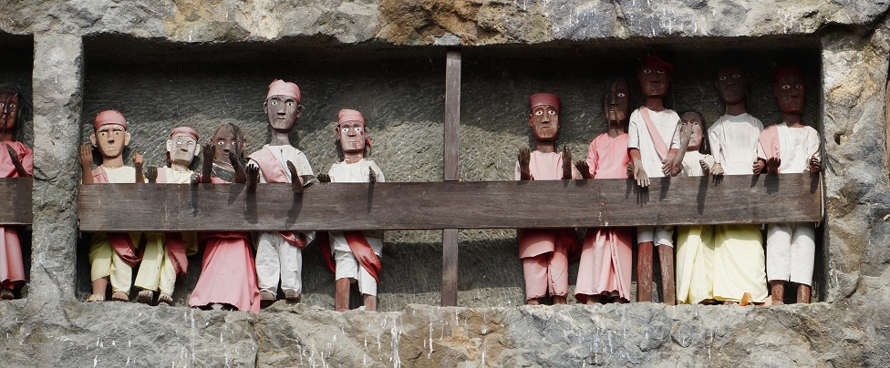 |
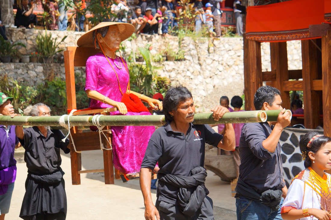
Derek Pugh
Nine hours drive from Makassar, in the mountainous South Sulawesi is a region known as Tana Toraja, with its capital at Rantepao. It is populated by the Torajans, a proud ethnic group of mainly Christian people with animist leanings, who enjoy a kind of celebrity status in Indonesia because their unique architecture, culture and funerary customs are well known by all and a ‘must see’ on everyone’s bucket list.
Like most travel in Indonesia it is it remarkably easy to get there. I contacted a driver, Pak Rasyid, by phone, and he took me under his wing and looked after me for a week. Flying in to Makassar from Bali, he was waiting with a handy sign at the airport and within minutes we were on the road north and in the highlands at a Rantepao resort by nightfall.
The Torajan culture appears to be alive and well, perhaps in spite of decades of tourism promotion by the government. Torajan houses, called tongkanan, are at the centre of every village and daily life, and they are everywhere in this part of the highlands. These magnificent carved houses stand high on wooden piles with huge sweeping curved arc roofs, apparently reminiscent of the shape of the ships that brought the Torajans to Sulawesi some 25 generations ago. The Torajan colours of red, yellow, and black add exquisite detail to the carved patterns of the walls.
Christianity was brought by Dutch missionaries early last century, but for many the old animism customs continue, particularly in their dealing with the dead and beliefs in reincarnation. Wealth was traditionally measured by the number of buffalos a family owned, though these days it is augmented by remittances from family members who live elsewhere, and income from tourists. The government ensures there are a few sites identified and promoted for tourism purposes, which has the advantage of protecting a thousand other traditional family sites by concentrating the effects of their ceaseless tramping feet. It also allows for the hosts of souvenir shops that gather around each attraction like tax collectors around a Roman temple. In these crowded commercial dens you can buy everything from your very own tautau effigy of the dead, razor sharp swords and bamboo flutes, to Torajan coffee, cloth and sailing ships in bottles.
“Tomorrow,” Pak Rasyid told me, “we will go to see some caves and you can buy a souvenir.”
________________________________________________
“That’s where I’ll be put, up there,” said Remi: young, vital, and clearly not about to die soon. He was pointing to a pile of coffins. They weren’t stacked neatly, but one upon another wherever they fit. They were mostly plain wooden boxes, although occasionally one was delicately carved with Torajan motifs. Lower coffins were ancient rotting shells whose walls had crumbled so badly that bones had tumbled out.
“All my family is there, for hundreds of years.”
“And those bones…?”
“Yes, my ancestors, but long ago. You can see my grandfather up there on the left… the red coffin.”
His grandfather clearly hadn’t been there that long, but like the others his casket had been pushed into the gap so that at least part of it was within the shallow limestone cave. The cave already seemed full.
“What happens when you can’t get any more coffins in?” I asked.
“Simple, we’ll cut the cave larger. The nobles all have graves carved straight into the rock, look up there.”
Remi pointed out square holes which had been carved straight into the limestone cliff, high up on the wall above us. They had padlocked doors to deter grave robbers, but some were so high the lack of bamboo scaffolding needed to reach them must have been protection enough. Outside the rich graves, wooden effigies of the dead, tautau, sat on carved ledges, their bone-white eyes gazing out across the valley.
We entered a cave at the base of the limestone cliff. Bones and rotten caskets lay everywhere. Many of the skulls had been collected and placed along rock ledges. They leered back at me in the gas-lamp light Remy was charging 50,000 rupiah to use.
One broken casket had several skulls lying among a tangle of long bones and ribs.
“Poor people are buried in here. Sometimes they use the same coffin many times. The bodies rot down to make more room.”
Why such elaborate funerals here in Toraja? Why are they so important?
Reincarnation, I was told. When people die they are really only just sick. They sit, mummified, in a corner of the house, sometimes for years, until the family can lay on a lavish funeral. Only then can reincarnation occur.
A thought occurred to me. “These poor people, the ones who share coffins… would it be possible for a person to be buried in the same coffin again and again, each time he was reincarnated?”
Remi laughed. “I am sure it has happened.”
I wondered what it would be like to know so much about what was going to happen after death. Could I find out?
“What if I moved to Toraja – would I be allowed to be buried in one of these caves?”
“No, it is only for Torajans,” said Remi.
“What if I brought a lot of money,” I proffered.
“Give it to me now, and I’ll see what I can do… maybe,” he grinned.
The next day Pak Rasyid told me of a Torajan funeral across the valley we could see. I hesitated, would a tourist be welcome at such an event?
“Of course,” he said. “Everyone is welcome. The funeral is a huge celebration of life. People save for it their whole lives. It is aluk todolo, the way of the ancestors.”
As we approached, we could see red flags on houses, and hundreds of darkly-clothed people waiting under elaborately carved shade houses. A group of young children, princesses, were gathered by an open-sided shelter. We stopped and chatted. They were dressed in white, with red, yellow, and black beaded headdresses and belts and were waiting for the tautau to arrive. The effigy would be placed on a chair at the back, and her immediate family would sit around her, and eat the food brought to them.
The old lady, Ibu Bertha Duma, had been ‘noble’ and wealthy, so the crowd waited in anticipation of an extravagant show. She had died the previous year and this was the first day of the several days of ceremony and celebration. As a corpse, she had been thought of as ill, or sleeping, and she had been symbolically fed and dressed by the family each day since she had died. Even now, everyone knew her soul was lingering around the village, waiting for the last day of the funeral when her body would be placed in a high cave, carved into the family’s cliff. Only then could her spirit depart for Puya, the Land of Souls, accompanied by the spirits of the buffalos slaughtered at her funeral.
A dozen elderly women in purple silk shirts and intricately patterned sarongs started to rhythmically beat a drum log, and pigs were carried in, tied tightly to poles. A buffalo was led down the path into the village by a group of youths. This was the first of thirty brightly decorated buffalos, worth $2000 each, which would be slaughtered and shared out among the villagers.
The horns and jawbones of the offerings would return to the house and be attached to the growing stack against it. More horns mean higher status.
The drumming started again and music from reed flutes announced the arrival of the tautau. The old lady had been replicated in wood. She sat on a chair which was tied to bamboo poles for the porters. She was resplendent in a bright purple dress with orange beaded necklaces and conical shade hat. A large ring glinted on a wooden finger as a crowd danced it to its place. The princesses busied themselves to welcome it and the kin of the deceased moved into walled family stalls around it, ready for lunch.
Two lines of black-clothed man and women holding a bright red strip of cloth above their heads arrived. The women wore beaded necklaces of the same orange colour as the tautau. A hundred meters or more long, the cloth was tied to the elaborately carved coffin, carried on a bamboo frame by several dozen men. There was no sadness. The coffin was danced down, and thrown about in joy. People laughed and cheered and shouted advice, the drumming was incessant. A hundred helping hands passed the coffin five meters up a ramp to a shaded platform, carved and painted in red, black, and yellow. Prayers were called out across the crowd, unintelligible to me in the Torajan language.
On the ground below, the first buffalo’s jugular was stabbed by a flattened spearhead. Its removal drew out a bright red fountain, but the beast made no sound as it slowly collapsed. It was quickly butchered, and another behind it, in a flurry of small black flies. Small children gaped in awe as the blood flowed.
The crowd shrank back into the shade as food boxes and water cups arrived for lunch. There was a pause as people ate.
We moved back to the tautau and took photographs of the family posing with it. The funeral had started well - despite the festering metal scent of fresh blood and the screaming of pigs, everyone was pleased.
The drumming started again and a line of about 50 men, dressed in identical dark purple shirts with Ibu Bertha’s name on their backs, formed a circle near the tautau. They held hands and began a slow dance, chanting a dirge. On and on they went, sadness fell across the crowd at last. This was, after all, a funeral.

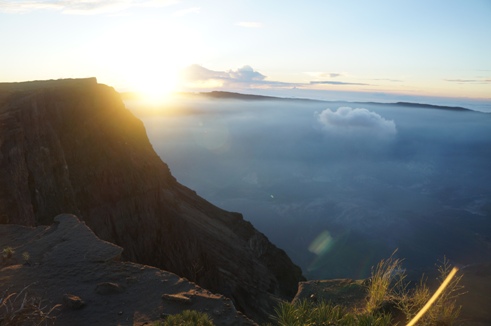
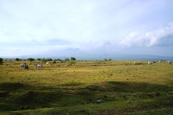


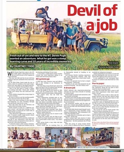
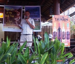
 RSS Feed